Trekking with Friends: Off to Sandakphu!
- Feb 9, 2025
- 26 min read
Updated: Jul 18, 2025
Trekking is always a good time—but it hits different when you’ve got your closest friends with you.
This was our fourth year of hitting the trails together—me, Tejas (aka Teja), and Anand (aka Andy). Over time, we’ve kind of made it a tradition. And every year, we try roping in more friends to join. This time, our "marketing" finally worked—Cassay and Sunil (aka Chendu) decided to come along!
After spending the last three years exploring Northern India, we were honestly a bit bored of the usual spots. So we decided to mix things up and head east. That’s how we ended up picking Sandakphu—a super scenic trek in the Eastern Himalayas.
What makes Sandakphu awesome? For starters, the views. You get to see Everest, Kanchenjunga, Lhotse, and Makalu—four of the five highest peaks in the world. And the coolest part? You’re literally walking along the India–Nepal border. One minute you're in India, next minute—boom—you’re in Nepal. No visas, no checkpoints, just epic mountain vibes.
Quick Trek Info:
Where: Singalila Range, Darjeeling (West Bengal).
Highest Point: 3,636 m (11,930 ft) – Sandakphu.
Trek Length: 7 days.
Distance: ~ 47 km.
Difficulty: Moderate.
Best Time to Go:
Spring (Apr–May): Flowers everywhere, especially rhododendrons.
Autumn (Oct–Dec): Super clear skies, best for views.
Winter (late Dec–Feb): Snowy and magical, but tougher.
The Prep Game
Like always, we started prepping months in advance. You can’t just show up and hope for the best—especially when you're going to be walking for days at high altitude. Here’s a rough breakdown of what we did to get trek-ready:
🫁 Cardio Work: We needed the stamina to walk 6–12 km every day (with backpacks!). So we did Brisk walks or hikes with loaded packs; Jogging, cycling; Stair climbing or incline treadmill; Swimming/rowing when we felt fancy.
🦵 Strength Training: Strong legs = happy trekker. We focused on Squats, lunges, step-ups, Calf raises, Core work: planks, leg raises, Russian twists.
🤸 Stretch It Out: A little daily stretching goes a long way. Focused on hamstrings, calves, hips, lower back; Dynamic stretches before workouts, static ones after; Threw in some yoga a couple times a week.
🏔️ Altitude Acclimatization: We don’t live in the mountains, so we did what we could - Stair workouts (lots of them); Hydration and pacing ourselves early in the trek.
🎒 Backpack Practice: Once a week, we’d walk with 5–7 kg on our backs to get used to it. Shoulders and hips thanked us later.
So yeah, after all that prep, we were ready to roll. Bags packed, playlists loaded, and excitement levels through the roof. We kicked off our journey on February 2nd, 2025, with an early flight.
More stories from the trail coming soon—stay tuned!
Day 1: Flight to Bagdogra & Drive to Dhotrey – The Journey Begins
Treks are tough—but sometimes just reaching the base camp is half the battle.
For our Sandakphu adventure, the base camp was Dhotrey (also spelled Dhotre), a tiny, postcard-perfect village in the Darjeeling district of West Bengal. Sitting pretty at about 8,500 feet (2,590 meters), it's one of the most peaceful and scenic starting points for the Sandakphu–Phalut trek. If you're planning to explore Singalila National Park or chase views of Everest and Kanchenjunga, Dhotrey is the place to start.

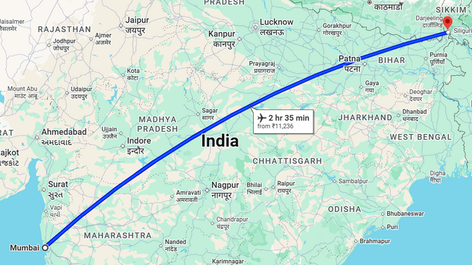


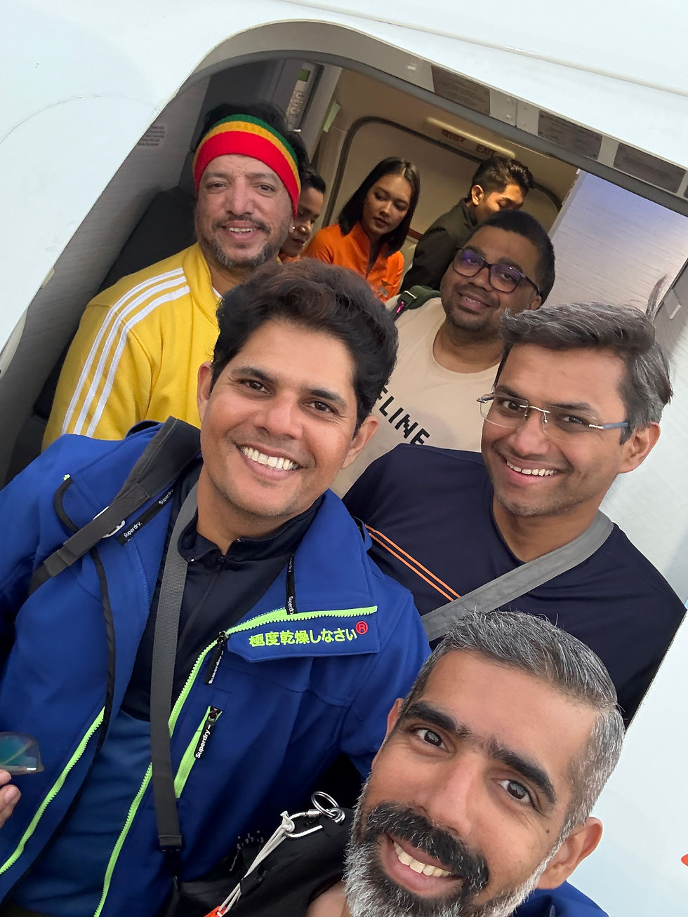
Mumbai to Bagdogra – Airport Chronicles
We booked an 8:00 AM flight from Mumbai to Bagdogra, and as usual, we stuck to our “early is better” rule—not just to skip security queues, but also to milk those free lounge meals (credit card perks FTW!).
We left Borivali at 5:00 AM in a pre-booked cab that could fit the four of us—Cassay, Andy, Chendu, and me—plus our massive trekking backpacks. Teja joined us directly at the airport since he lives on the other end of Mumbai (Chembur folks, you know the drill).
No traffic at that hour meant we reached the airport in a record 30 minutes. But of course, there was already a long queue outside the airport. While we were standing and chatting away, Teja showed up and casually walked into the DigiYatra line. That's when it hit us—we all had the DigiYatra app and completely forgot to use it. Classic!
While the others stayed in line, I dashed over to join Teja. With facial recognition tech, we were through in minutes. Next came bag check-in (yep, another queue), but the others joined us soon and we held their spot like good friends do.
Once our bags were sorted, it was lounge time! The Travel Club Lounge at Mumbai Domestic Terminal had a bit of a line too, but nothing major. Within 5 minutes, we were inside, grabbing quick bites and sipping on hot tea and coffee.

Before we knew it, the airline staff were calling our names for boarding. The 2.5-hour flight flew by (pun intended) thanks to endless jokes, planning, and mid-air banter. When you’re with your people, time just disappears.

Hello, Bagdogra!

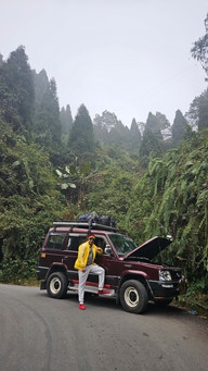
Touchdown in Bagdogra greeted us with a cool 15°C breeze—a big relief from Mumbai’s heat. Our driver was waiting outside, helped us load up, and we were off to Dhotrey.
Now, this drive isn’t just a ride—it’s a scenic transformation from tropical plains to misty hills and thick Himalayan forests. The journey is around 95–105 km and takes about 4.5–5 hours, depending on the road (and luck).
The roads started smooth but slowly turned into winding hill climbs and the occasional bumpy patch. We passed tea estates like Gopaldhara and Thurbo, lush green hills, jaw-dropping valley views, and could feel the temp dropping with every turn. It was our first real taste of Himalayan vibes.


The Unexpected Breakdown (and the Whiskey Story)
We made a few chai stops along the way (a must for warmth and stretching legs). Also, full disclosure—we stopped to stock up on some hard drinks for the trek. Not essential, not encouraged… but let’s be real: a little sip on a freezing night can feel like magic.
Then came the twist: a few kilometers into the hills, our car broke down. In the middle of nowhere. No passing cars. No signal. Just six guys and a dying vehicle.
We channeled our inner mechanics, poked around the engine, but nothing worked. Eventually, our driver figured it was a fuel issue and walked off—on foot—to get some.
And what did we do while waiting? First, we took photos. Then we got bored. So... we opened a bottle.


No cups? No problem. We used the bottle cap as a shot glass. A few sips in, and spirits were high again (pun intended, again). Soon enough, we spotted our driver in the distance, carrying a can of fuel like a hero in a movie.
Arrival at Dhotrey
After a quick refill, we were back on the road. When we finally reached Dhotrey, we were greeted with a warm welcome drink by our trek guide. We gulped it down and headed straight to our rooms.
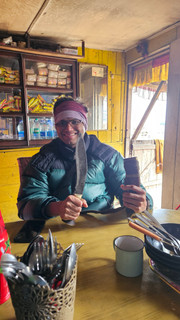
We were staying at a local homestay (Makaighar), so we weren’t expecting much—but it totally surprised us! Small, clean rooms with fresh linens and spotless toilets. We quickly freshened up and sat down for a simple, flavorful homemade lunch. Delayed, but absolutely worth the wait after that long, wild journey.

The rest of the day was spent unwinding, laughing, and planning our upcoming trek. In the evening, we strolled through the village, soaking in the cool breeze and admiring how locals live in such remote, cold conditions.
Right before dinner, our guide gave us a quick briefing about the trek, safety tips, and what to expect the next day. Dinner was again local fare—simple but tasty—and soon after, we were off to bed.
Our bags were packed and ready for an early start. The night got chilly—around 4°C, dropping to 2°C later. But wrapped in warm blankets and buzzing with excitement, we drifted off, ready for Day 2.
Day 2: Trek from Dhotrey to Tumling – Into the Woods and Across Borders
Let’s be honest—sleeping in 2°C isn’t exactly cozy, especially when the wind keeps howling like it’s got stories to tell. Most of us tossed and turned through the night, and by 7:00 AM, we were up—partly because of the cold, partly from excitement.
Our guide popped in to let us know breakfast would be served by 8 AM. Taking a bath in these temperatures felt like a trek of its own—and even the geyser seemed unsure about doing its job. But with some patience and prayer, we all managed to squeeze in a hot(ish) shower and gear up.
Morning Fuel
By 9 AM, breakfast was ready. A quick bite, nothing fancy—just enough to get us warmed up and prepped for our first day on the trail.
Phase 1: Dhotrey to Tonglu
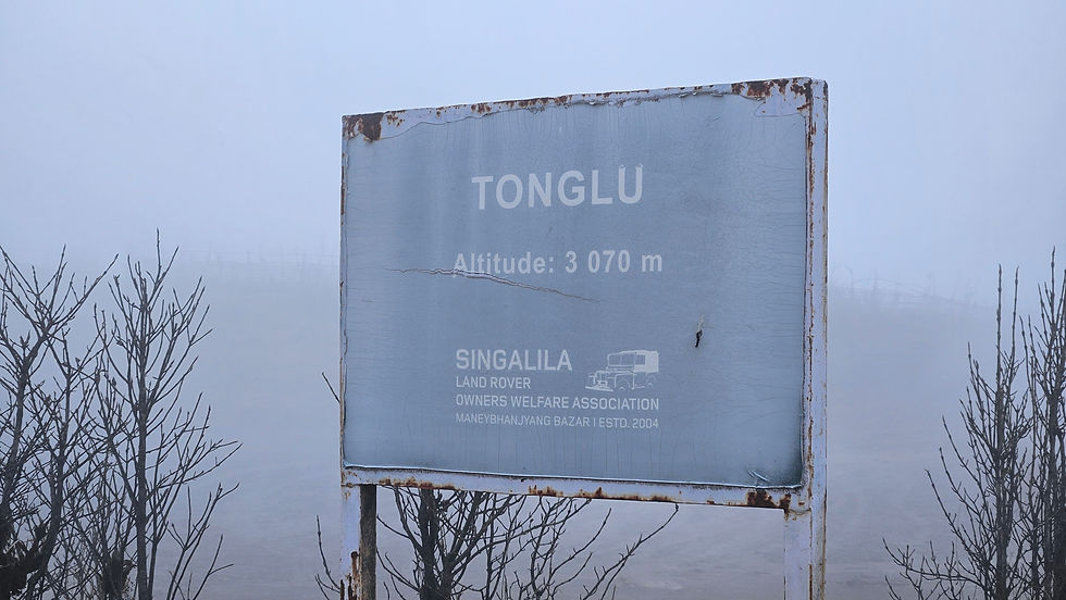
Start Point: Dhotrey (8,340 ft / 2,542 m).
End Point: Tonglu (10,130 ft / 3,087 m).
Distance: ~6.5 km.
Time: 3–4 hours.
Difficulty: Easy to Moderate.
Permit: Required (Singalila National Park Entry).
The trail starts right where Dhotrey ends—beyond the last few houses near a small local school. A stone-paved path leads you past a charming Buddhist chorten, fluttering prayer flags, and a peaceful little shrine where locals often say a prayer before beginning their trek.

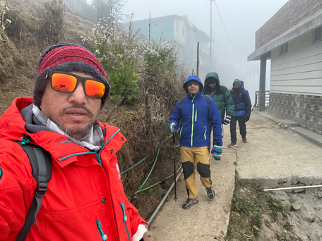


The first couple of kilometers were pure forest magic—tall pine, rhododendron, and magnolia trees wrapped in drifting mist. The path itself was a mix of soft dirt and stone steps, with birdsong and distant echoes of the hills keeping us company.


As we gained altitude, the trail steepened a bit. It wasn't too tough, but definitely a bit of a workout. We stopped now and then at scenic spots with views of the valleys and—on a clear day—Kanchenjunga in the distance.
Every so often, we’d see yaks or horses grazing by the trail, adding a surreal touch to the whole scene.
Hello, Tonglu!
After about 3.5 hours, the trees thinned out and we reached open meadows—Tonglu. A small, peaceful place with a few lodges and a trekkers’ hut. There’s also an Indian Army base here, quietly watching over the borderlands.
If you’re lucky and the skies are clear, this spot gives you one of the best panoramic views of the Kanchenjunga range—and maybe even a glimpse of Everest far off in the haze.
We grabbed Maggi and tea (standard mountain fuel) and settled into the cozy vibe.

There was even a puppy wandering around—Chendu made a new friend. Meanwhile, the rest of us tried out a kukri, the iconic Nepali blade. Very Gurkha vibes.


Phase 2: Tonglu to Tumling
Start Point: Tonglu (10,130 ft / 3,087 m).
End Point: Tumling (9,600 ft / 2,926 m).
Distance: ~2 km.
Time: 30 mins – 1 hour.
Difficulty: Easy.
Border: Tumling lies inside Nepal, but there's open movement for Indian and Nepali nationals.
After a short break and a few good laughs, we set off again—this time on a much gentler trail. It was a leisurely downhill walk, meandering through grasslands and pine groves.
The weather was kind. Mist floated through the valleys on one side, while the forest dipped quietly on the other. This part of the trail is also used by Jeep safaris heading to Sandakphu, so the path is wide and well-worn.
Locals passed us now and then, some on foot, some on horseback, and the occasional yak herding added to the mood.

Welcome to Tumling
About an hour later, we arrived at Tumling—a small cluster of colorful cottages and wooden lodges perched along a ridge. This is the kind of place that blurs borders; technically in Nepal, but you can stand here and still call it India. No passport checks, no hassles—just shared mountains.
The architecture was rustic, Himalayan, and charming, with prayer flags dancing in the wind. On clear days, Tumling offers views of Kanchenjunga, and even Everest if you're super lucky. Sadly, clouds had other plans that day.


We grabbed our rooms—Andy and I in one, while Teja, Chendu, and Cassay bunked together. After a quick freshen-up, it was lunchtime: rice, dal, sabzi, boiled egg, and pickle. Nothing extravagant, but warm and satisfying—just what our tired bodies needed.

A Chilled-Out Evening
Post lunch, we dozed off for a bit. The wind outside had picked up, and the temperature was dropping again. By evening, the cold had us all staying indoors—no brave treks outside this time.
So, what do five friends do in freezing temperatures? We stayed in, chatted, laughed, and yes, had a little bit of that whiskey we packed. Nothing warms you up like good company and a small sip of something strong.
Dinner rolled around 8 PM, a repeat of lunch with the same comforting flavors. By now, the temperature had dipped to 1°C, and the wind howled louder than ever. Sleeping wasn’t easy—but with our trek officially underway, spirits were high and hearts were warm.
Day 3: Tumling to Kalpokhri – Chasing Clouds and Conversations
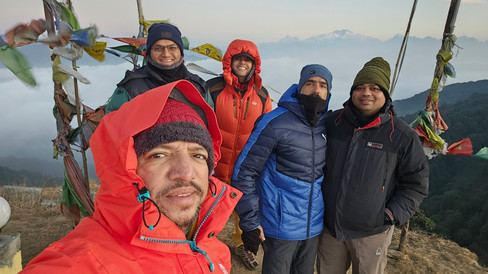
After yet another sleepless (or let’s say sleep-lite) night, we were up by 5 AM, shivering but excited. But nope—it wasn't time to get ready for the trek just yet. This was the golden hour, and Tumling is famous for a reason: the sunrise over Kanchenjunga and Everest is something you don’t ever want to miss.
Just behind our homestay was a small hill. By 5:45 AM, Andy, Cassay, and I were already climbing it, armed with our cameras and sleepy smiles.
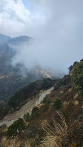
Above the Clouds
No words really do justice to what we saw. You’re standing above the clouds, with the Himalayan giants rising all around you. The India-Nepal border road weaves through the hills like something out of a painting—no fences, no wires—just nature’s own boundaries.


Soon Teja and Chendu joined us, and none of us wanted to leave. So what followed? A flood of photos, laughter, and the occasional "just one more" shot.


But all good things are cut short by one thing on treks: your guide.
He showed up, smiling (of course), and reminded us it was time for breakfast and to hit the trail. We headed back, freshened up, and by 7:30 AM were tucking into aloo puri and boiled eggs. Fuel for the trail ahead.

Tumling to Kalpokhri Trek Overview
Start Point: Tumling (9,600 ft / 2,926 m).
End Point: Kalpokhri (10,400 ft / 3,170 m).
Distance: ~9 km.
Duration: 4–5 hours (moderate pace with breaks).
Difficulty: Moderate.
Permit: Required (Singalila National Park, checked at Gairibas).
Trail Type: Mixed terrain – forest paths, clearings, and ridges.
Before we left, our guide gave us a lovely piece of mountain trivia. The Kanchenjunga range is often called the "Sleeping Buddha", thanks to the way its five peaks align to resemble a reclining figure. Once you see it, you can’t unsee it.
The Trail Begins
We began on a gently descending motorable trail, shared by trekkers and the occasional 4x4 vehicle. The path wound through pine and bamboo forests, broken by scenic clearings with postcard-worthy Himalayan views.


We reached Gairibas (8,600 ft / 2,621 m) in about two hour or so. It’s a small settlement with a Singalila National Park checkpoint. Even though we weren’t particularly hungry, the smell of fresh food changed our minds—and a quick snack break turned into a small feast.

From there, the trail climbs more steeply, winding through dense forests bursting with birdsong. In spring, this stretch is a tunnel of blooming rhododendrons, and even now in late May, it had its own green charm.
Lunch at Kaiyakatta
After a steady uphill climb, we reached Kaiyakatta, a small flat clearing dotted with a few tea stalls. We stopped here for lunch—a simple but satisfying plate of dal, rice, and sabzi, just enough to keep our energy up.


From Kaiyakatta, the trail climbs gradually but consistently toward Kalpokhri. This stretch is particularly scenic, crossing back and forth between India and Nepal. The shift in culture, architecture, and trail design becomes more apparent as you go. Prayer flags and Buddhist chortens guide you forward like silent companions.
Conversations & Catching Up
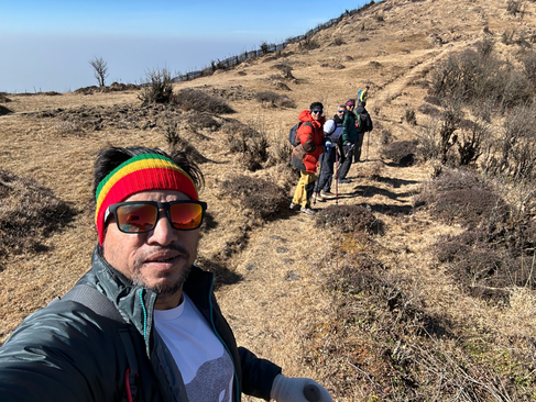
Andy, Teja, and Cassay led the way—fit, fast, and always ahead. Chendu and I brought up the rear, walking slower but soaking it all in. We shared stories, secrets, and laughs, letting the mountains be our witness.
By around 4 PM, we reached Kalpokhri. It was colder, windier, and much moodier than Tumling. The clouds had completely rolled in, dropping visibility and raising the chill.

Kalpokhri: A Place Wrapped in Mist
Our homestay (Yalung) was a basic wooden structure with thin metal sheets for roofing—not ideal for strong mountain winds. Every gust made the sheets wobble and groan, as if the wind itself was complaining.
We warmed up in the kitchen with hot soup and popcorn, surrounded by quirky details—wooden barrels of local wine, bottles shaped like totems, and a pair of clocks showing India and Nepal time side by side.


The cold had us beat, so we stayed in. This time, Chendu and I shared a room, while the rest bunked together. We kept chatting, nursing a glass of whiskey to thaw out, before heading back to the kitchen for dinner: rice, dal, sabzi, egg curry, and pickle. Simple, but soul-satisfying.

A Long, Cold Night
By 10 PM, we were in bed. But "sleep" was wishful thinking. The winds howled, the metal sheets creaked and banged, and the temperature dropped below 0°C. Even with three thick blankets, it was hard to stay warm, let alone sleep.
Still, the day had been incredible—views, stories, and that feeling of being lost in the right direction.
Day 4: Kalpokhri to Sandakphu – Into the Clouds and Onto the Ridge
Sleep? What’s that?
After a restless night in the freezing winds of Kalpokhri, I finally gave up trying to sleep and decided to scroll through my phone—one bar of network, one bar of hope. Up here, you’re not supposed to have phone signal, but we were lucky to have a whisper of connectivity until today.
By 5 AM, I peeled myself out of the blanket. Chendu was still snoring like nothing had happened, so I tiptoed over to check on the others.
Knock knock.
“Girish, come in!” came Andy’s voice from behind the door. Inside, Andy, Teja, and Cassay were buried deep in their three-layer blanket forts. Teja was closest to the door, so Cassay gave him a friendly kick to open it. I jumped straight into Andy’s blanket—because that’s what boys do when it’s below freezing!
Apparently, their room was much quieter than ours. I told them how lucky they were. Misery does love company, but I was secretly jealous.
Cold Mornings and Warmer Water (Sort of)
Getting ready was... brutal. Imagine putting your hands in freezing water, never mind a shower or, well, cleaning anything else. The homestay staff, bless them, gave us thermos flasks of warm water. But as soon as you poured it into a bucket, it cooled down instantly. Still, better than nothing.
We took turns freshening up, each of us encouraging (read: mocking) the other to go next.
A Detour Before the Trek
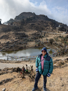
Before heading to Sandakphu, our guide suggested we visit Yuma Pokhari, a sacred lake just a few meters from the homestay. Andy, Teja, Cassay, and Chendu went to check it out. I decided to stay back—maybe it was the lack of sleep or just the chill.


They were back in about 45 minutes, and we geared up. Just before leaving, we made a quick call back home to let our folks know we’d be off the grid for the next few days.
The Kalpokhri to Sandakphu trek is one of the most scenic and rewarding stretches of the larger Singalila Ridge Trek in the eastern Himalayas. This segment forms part of the route that leads trekkers through the Singalila National Park, straddling the Indo-Nepal border, offering panoramic views of some of the world’s highest peaks.
Trek Snapshot: Kalpokhri to Sandakphu
Start Point: Kalpokhri (10,171 ft / 3,100 m).
End Point: Sandakphu (11,929 ft / 3,636 m).
Distance: ~6 km.
Duration: 2.5–4 hours.
Difficulty: Moderate (due to steep ascent and altitude).
Trail Type: Steep uphill with a mix of stone and dirt paths.
On the Trail
We started together, walking as a group along a gentle incline. But—as tradition now dictated—Andy, Teja, and Cassay picked up pace and were soon ahead. Chendu and I, the “leisure trekkers,” took our time, clicking pictures, soaking in the views, and occasionally gasping for breath.


The final stretch from Bikheybhanjang to Sandakphu was both the toughest and most rewarding part of the day.
The trail splits here:
Right Fork: Vehicle track — easier but less scenic.
Left Fork: Trekker’s trail — steeper, narrower, stunningly beautiful.
We took the left trail. It wound through shrubs, rocky steps, and open ridges. The climb was tough, the air thinner, and the pauses more frequent. Every 15–20 minutes, we had to stop—not just to catch our breath, but to absorb the beauty around us.


Between the Mountains
At one point, the trail narrowed into a 2-meter-wide path flanked by steep valleys on both sides. The clouds had rolled in thick, and visibility dropped sharply. It felt surreal—walking between two worlds, telling yourself, “Don’t look down. Just walk.”
The last 700 meters were relentless. The gradient increased, wind picked up, and the temperature dropped sharply. But then, as we crested the final ridge—prayer flags flapping, stone markers welcoming us in—we had made it.
Welcome to Sandakphu.
And there it was—Sandakphu, the highest point in West Bengal, perched atop the Singalila Ridge.
A View That Stuns in Every Direction:
West: The Everest cluster – Everest, Lhotse, Makalu.
North/Northeast: The mighty Kanchenjunga and the Sleeping Buddha.
South: Rolling ridges of Darjeeling and Bengal.
Northwest: Bhutanese Himalayas peeking in on a clear day.
This place is magic.
Sandakphu is a small settlement with basic lodges, tea stalls, and a few Land Rovers parked—reminding you that yes, it is reachable by road, but you definitely earned it the hard way.
Home for the Night
Our homestay was a two-story wooden lodge with thin metal roofing. This time, Andy, Chendu, and I shared a room, while Teja and Cassay took another. They were kind enough to give us the quieter room, predicting theirs—being closest to the edge—would bear the brunt of the wind. And boy, were they right.
Both rooms offered spectacular views of the mountains. Andy quickly recorded a video before darkness set in.
The Reality of High-Altitude Plumbing
The rooms were clean, and the bathrooms were tidy. But—no water in the taps. Apparently, pipes freeze solid, making geysers useless. The owners had removed them and instead placed large water barrels outside. You had to fill your bucket manually for everything from brushing to bathroom business. Trekker life, folks.
Evening Vibes: Tea, Tunes & Tequila (Well, Almost)
The dining area felt like a 3-star mountain restaurant—spacious, warm, and bustling with trekkers. We had our evening tea, chatted, and chilled. Chendu wasn’t feeling great, so he took a nap.
Later, our guide called us down for some entertainment—a local-style mountain party!
Cue: Drinks, food, karaoke, and lots of dancing.

Andy wasted no time grabbing the mic, belting out tunes like he was on Indian Idol.
Soon, we were all on the dance floor, cold forgotten, smiles on full blast.
Lights Out
Dinner was simple and satisfying. I don’t even remember what it was—I was that tired. After very little sleep the previous night and the steep trek, I crashed the moment I hit the bed. The room was cozy, and I was grateful again to Teja and Cassay for their sacrifice.
Chendu, unfortunately, wasn’t feeling great and kept waking up through the night. Andy gave him meds hoping some rest would help him recover before the next stretch.
What a day. What a climb. What a view.
Day 5: Sandakphu to Phalut / Sabargram – A Test of Grit and Friendship
We were up by 6 AM in Sandakphu. I felt surprisingly fresh after a good night’s sleep—the kind you only get after a hard climb and a warm meal.
But Chendu wasn't doing well. The altitude had finally caught up with him. While the rest of us stirred, got ready, and braved the biting cold to freshen up, he stayed curled up under layers of blankets, his body clearly fighting back.
While Cassay and I were getting ready, Andy and Teja stepped out to capture the early morning views.


Mornings in the Mountains = Ice Buckets
Ah yes, the water barrel.
I stepped out to fill my bucket and was greeted by a thin sheet of ice on the surface. No hot water here. We were at 3,636 meters—and this was easily colder than Kalpokhri. Let’s just say we did what we had to. No baths, obviously. Trekkers know better.
By 8 AM, we were at the breakfast table—roti, subzi, and boiled eggs. Simple, hearty, warming. Then, it was time to shoulder our packs and hit the trail.
Trek Snapshot: Sandakphu to Phalut
Start Point: Sandakphu (11,929 ft / 3,636 m).
End Point: Phalut (11,811 ft / 3,600 m).
Distance: ~21 km.
Duration: 7–8 hours.
Trail Type: Undulating ridge trail.
Scenic Rating: 🌟🌟🌟🌟🌟
This stretch of the Singalila Ridge is one of the most exhilarating and desolate sections. Far fewer trekkers. Far grander views. A real sense of walking on the edge of the world, with snow-capped peaks in nearly every direction.


Plans and Pace
The plan was simple:
Reach Sabargram (~14 km) by 1 PM.
Break for lunch.
Continue to Phalut (~7 km more).
We started together as always, but it was immediately clear: Chendu was in no shape to keep pace.
While Andy, Cassay, and Teja continued ahead, I stayed back with Chendu. Our guide stayed in range, keeping a watchful eye.
Crisis on the Ridge
About 4 km in, Chendu sat onto a rock, drained of energy. It was already 12 PM, and we were dangerously behind schedule. The trail to Phalut is remote, with no vehicles or horses past this point.
It was decision time.
The guide and I agreed—Chendu should turn back, this was the last chance. By some miracle, we spotted a single vehicle nearby. We waved, shouted—but the driver didn’t see us. That was it. Our one shot, gone.
Then, Chendu did something heroic. Despite the pain and nausea, he stood up, looked at us, and said: "Let’s keep going."
With energy drinks in hand and hope in our hearts, we pushed forward.
The Slowest, Hardest Trek of My Life
A stretch that would normally take 2 hours took us nearly 5. Chendu was moving inch by inch, step by step. I was constantly checking his breathing, his color, his pace.
By the time we reached Sabargram, it was 5:30 PM. We were exhausted, frozen, and emotionally drained.
Emergency Halt: Sabargram Ranger Camp
Phalut was out of the question.
We stayed the night at a forest ranger outpost—basic, functional, and exactly what we needed. No spare clothes. No network. Just the two of us in the same clothes we’d hiked all day in—our bags were on the horse that reached Phalut already.
Luckily, we had small daypacks with essentials—medicine, power banks, electrolytes, and energy bars.
While I stayed with Chendu inside, our guide ventured into the night—crossing into the Nepal side of the mountain to reach our friends on phone and let them know we were safe.
It was pitch dark, freezing, and dangerous. But he didn’t hesitate.
The Longest Night
It was easily -4°C or lower. And it was the most fearful night of the entire trek for me.
I didn’t sleep. I just kept watching Chendu breathe, making sure he was okay, making sure he didn’t get worse. The silence of the ranger hut was deafening, interrupted only by the wind howling across the ridge.
Meanwhile, At Phalut...
Andy, Teja, and Cassay made it to Phalut. They had no idea what had happened until our guide's message reached them.
They were worried—especially about Chendu—but also got a closer view of the mighty peaks. It was bittersweet.


Lessons from the Trail
Altitude is no joke. It humbles the strongest of us.
Friendship is tested in the cold. And I’m proud we stuck together.
Sometimes reaching the top isn’t the goal—getting through it is.
Day 6: Sabargram / Phalut to Ghorkhey – A Journey Through Grit and Grace
After a restless night—no sleep for me and barely any for Chendu—we were both awake by 6 AM. But neither of us wanted to move. It took us another hour to muster the energy to leave the bed. I freshened up first, while Chendu sat soaking in the morning sun, slowly warming both his body and spirit. Gradually, he got ready.

Despite the struggle, Chendu stood up, smiled, and said, "We’re gonna make it." His thumbs-up gave me some relief, although I was still worried. We had 14 km to cover through dense forest. While we were heading to lower altitudes—which meant better conditions for him—the descent wasn’t going to be easy.
The Sabargram to Ghorkhey Trail
The Sabargram to Ghorkhey trek is a breathtaking downhill journey through some of the most peaceful and untouched forests in the Eastern Himalayas. Offering a dramatic shift in landscape—from high-altitude ridges to lush, forested river valleys. This route is rich in biodiversity and silence—exactly the kind of solitude trekkers long for.
Trek Overview: Sabargram to Ghorkhey
Start Point: Sabargram (11,4823 ft / 3,500 m).
End Point: Ghorkhey (7,054 ft / 2,150 m).
Distance: ~14 km.
Duration: 4.5 to 6 hours.
Difficulty: Moderate (slippery sections, long descent).
Trail Type: Continuous descent through meadows and forests.
We began our descent around 9:30 AM, keeping a slow pace. Chendu and I chatted the entire way, trying to keep his mind distracted from the pain. I could see it on his face—it wasn’t easy. A few Indian Army personnel we passed advised us to head to a nearby camp for oxygen, but that would have required a 1 km detour. We decided to keep pushing forward.
Once we entered the forest, the real magic of this trail began to unfold.
Narrow earthy trails blanketed with leaves and pine needles. Gentle switchbacks. Mossy rocks and trees that looked like they belonged in a fairytale. Towering oaks, chestnuts, and maples filtered dappled sunlight through their canopies. Birdsong surrounded us—sunbirds, flycatchers, and maybe even a Himalayan monal if we got lucky. We didn’t see any red pandas or barking deer, but something about the silence made you believe they were nearby.
Meanwhile, from Phalut...
While we navigated this surreal trail, Teja, Andy, and Cassay descended from Phalut and reached Ghorkhey by around 3 PM.
Trek Overview: Phalut to Ghorkhey
Start Point: Phalut (11,811 ft / 3,600 m).
End Point: Ghorkhey (7,054 ft / 2,150 m).
Distance: ~15 km.
Duration: 5 to 6 hours.
Difficulty: Moderate.
Trail Type: Descent through forests and alpine meadows.


A Glimmer of Network, Then a Twist
Chendu, our guide, and I kept checking our phones for any signal. Our guide was hoping to arrange a horse from Samanden—a quaint little village just a kilometer before Ghorkhey. I wanted to call Andy to update him on Chendu’s condition. Andy’s a doctor, and I knew he’d have advice on how to ease the symptoms of altitude sickness.
About 3 km before Ghorkhey, we finally got a signal.
Two quick calls:
Our guide arranged for a horse from Samanden.
I called Andy. He calmly assured me, “It’s altitude sickness. He’ll be fine once we descend further.”
A sigh of relief. We were almost there.
But just as we entered Samanden, fate had another curveball for us—I felt a sharp pain in my right knee. I couldn’t bend it, and every step downhill was agony. Still, somehow, we limped our way into the village and sat down to recover.
Our guide brought us cold drinks—probably the most refreshing sip I’ve ever had. We hadn't had lunch, so it helped.
The first thing we did? Got Chendu on the horse. The final stretch was underway.

Welcome to Ghorkhey
Despite the pain, I continued on foot.
And finally, the forest parted and Ghorkhey appeared—a fairytale village nestled in a river valley, surrounded by pine trees. The Gorkhey Khola flowed gently through it, flanked by neat wooden homes and terraced fields.
I was overwhelmed—not just by the beauty, but by the moment. Chendu had made it. In pain. In silence. Still smiling.
Reunited & Recharged
Seeing Andy, Teja, and Cassay waiting at our homestay was incredibly emotional. They could read the exhaustion and worry on my face immediately.
The homestay? It felt like a 5-star escape in the middle of nowhere—clean rooms, warm beds, and friendly hosts. Cassay and I shared one room while Teja and Andy stayed with Chendu.
The first thing I did? A hot water bath. The owner kindly provided a bucket of steaming water, and it felt like heaven.

BBQ, Bottles, and a Warm Night
The temperature hovered around 10°C—positively warm after the freezing cold of previous days. Our host arranged a BBQ under the stars, and we brought out our bottles once again—not just to celebrate the trek, but to toast Chendu’s resilience and strength.

That night, we all collapsed into bed—exhausted, relieved, and deeply grateful for the journey.
Day 7: Ghorkhey to Siliguri – The Final Descent
Today marked the end of our incredible trek through the Singalila range. Our plan was to return to Siliguri by car—but first, we had to reach Bhareng, the nearest point accessible by vehicle. That meant one last uphill walk: a 4 km trek from Ghorkhey, which would take us little over an hour.
Waking Up in Paradise
We woke up around 7 AM, feeling refreshed and well-rested. It was only then, in the light of morning, that I fully appreciated the beauty of Ghorkhey—a hidden gem tucked away in a lush, pine-covered valley. The Gorkhey Khola river, gently winding through the landscape, marks the natural boundary between West Bengal and Sikkim.
The village felt like a step back in time: around 30 families, mostly farmers, live here. A few have opened their homes to trekkers, offering cozy homestays. Electricity is minimal—some homes run on generators or inverters—preserving the charm and simplicity of village life.
A Familiar Breakfast and the Journey Begins
By 8 AM, breakfast was ready. The usual—roti, sabzi, and a boiled egg. Familiar, hearty, and comforting.
By 9 AM, we were packed and ready to move. Since Chendu was still recovering, we didn’t want to risk another trek for him. A horse was arranged, while the rest of us—Teja, Cassay, Andy, and I—opted to walk.
After a round of final photos in Ghorkhey, we set off toward Bhareng.


The Uphill Trek to Bhareng
The path to Bhareng was a stony one, but not too difficult—at least not for most. My right knee was still aching, making every step a challenge. I told the others to go ahead and that I’d catch up.
But true to form, they refused to leave me behind.
All three—Cassay, Teja, and Andy—walked beside me the entire way. Every time I paused to rest, they paused too. No complaints. No rush. Just pure support. And of course, Teja turned into the unofficial photographer, making every rest stop a mini photo session.


Bhareng & A Scene from a Movie
We finally made it to Bhareng. The car hadn’t arrived yet, and neither had Chendu, so we took in the scenery. At one point, we spotted a man sprinting by with a huge stack of green hay on his head—our guide estimated it weighed around 40 kg.
In that moment, I couldn’t help but shout “Kantara!” (yes, inspired by the movie) and caught it all on video. It felt cinematic.
Soon after, both Chendu and our vehicle arrived. Our driver loaded the bags onto the carrier, and we hit the road toward Siliguri.
The Road Back to Civilization
The 135 km drive from Bhareng to Siliguri took us about five hours. We descended from an altitude of ~1,850 m to ~120 m, and with it, the temperature, landscape, and vibe all shifted dramatically.
This journey was more than just a return to the city—it was a transition from the serene silence of the Himalayas to the buzzing plains of North Bengal. We passed:
Tiny hamlets tucked into hillsides.
Rolling tea gardens.
River valleys and bustling hill towns.
Midway, we stopped at a market in Jorethang—grabbed some local goodies, had lunch, and stretched our legs before completing the final leg of our road trip.
Arriving in Siliguri – Comfort and City Lights
By 3 PM, we reached our hotel: Barsana Hotel & Resort. Nestled in a quieter part of the city, it was the perfect balance of comfort and calm after the rigors of our trek.
After checking in, we all headed to our rooms, unpacked, and freshened up. With no set plans for the evening, we wandered over to City Centre Mall—a bustling complex with shopping outlets, a multiplex, a food court, gaming zones, and more.
It was a complete contrast from where we had just been—but exactly what we needed.
Dinner, Music & Reflection
We had dinner at a restaurant in the mall with live music, great food, and warm staff. After a week of rough trails, altitude sickness, and unpredictable weather, it was the perfect way to celebrate.

Back at the hotel, we finally collapsed into bed—tired, full, and content.
And Just Like That… It Was Over
This final stretch—from Ghorkhey to Siliguri—wasn’t just a change in location. It was a return to the world we’d temporarily left behind. The mountains gave us silence, challenge, and perspective. And now, as we eased back into the rhythms of everyday life, we carried with us something deeper: stories, strength, and unforgettable memories.
Day 8: Siliguri to Mumbai - Back Home
Our return flight was scheduled for late afternoon, giving us the perfect window to unwind, reflect, and soak in our last few hours of vacation. We woke up late, free from alarms or agendas, and enjoyed a leisurely breakfast at the hotel—one last indulgence before heading back to the hustle of daily life.

The calm of the morning lingered as we relaxed around the hotel, sharing laughs, sipping chai, and recounting our favorite moments from the trek. It was comforting to know that while the journey was coming to an end, the memories would stay with us forever.
By noon, we checked out and headed to Bagdogra Airport, a short drive away. Being a small airport, the check-in and security process was surprisingly smooth and quick. As always, we did our usual scan for free lounge access—our little airport tradition. This time, only Cassay and Andy struck gold, managing to get in with their cards. They quickly fueled up and rejoined us just in time for boarding. No flight waits for wandering foodies, after all!
As we finally settled into our seats, watching the hills fade into the clouds beneath us, it hit us—we were going home.
Back to the traffic, routines, and deadlines.
But also, back with hearts fuller, minds clearer, and spirits stronger.
We didn’t just trek the Himalayas—we lived them, felt them, and now carried a piece of them within us.
And with that, our Sandakphu–Phalut journey came to a close.
One trail ends, another awaits.
Final Thoughts: A Trek That Stays With You
Eight days. Countless memories. From the misty trails of Chitrey to the panoramic highs of Sandakphu and Phalut, and the soul-stirring quiet of Gorkhey to the comfort of Siliguri’s city lights—this trek was more than just a journey through the Himalayas. It was a journey through grit, connection, vulnerability, and growth.
We faced altitude sickness, sleepless nights, knee pain, and steep descents—but also woke up to sunrises over Everest and Kanchenjunga, laughed around bonfires, and shared countless quiet moments that brought us closer not just to nature, but to ourselves and each other.
Each trail had its own story, every meal a small celebration, and every homestay a warm hug after a long walk. And in the face of physical strain, there was always someone lending a hand, cracking a joke, or walking at your pace just so you wouldn’t be alone.
If you’re planning this trek—know that it’s not just a trek. It’s a test, a teacher, and a memory etched in the ridgelines of your soul. Pack wisely, walk slowly, breathe deeply, and above all—soak it all in.
Because in the end, it's not the kilometers you count, but the moments that moved you.
Until the next adventure,
Keep wandering, keep wondering.

Comments